South Australia’s glorious deserts

Although we live in a time of dense urban development, convenience and infinite coffee choices, our state plays host to some of the most remote places on earth.
Within a day or two from Adelaide you can be camping among desert dunes beneath the starriest of skies.
Here we look at three of South Australia’s great desert regions. All these trips require a high clearance 4WD vehicle with low range.
1. Simpson Desert (Munga-Thirri–Simpson Desert National Park)
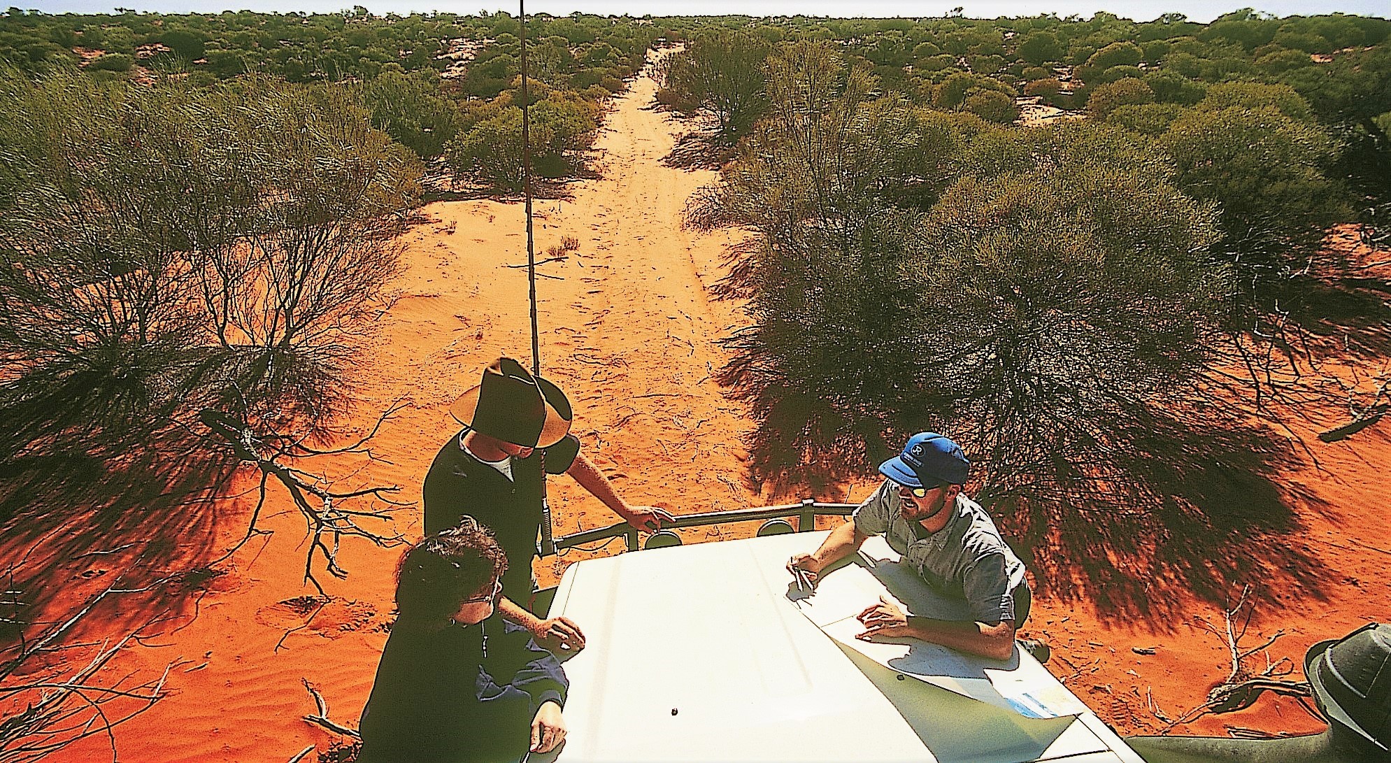
If it wasn’t for oil and gas companies scratching around in the Simpson Desert during the ’60s and ’70s, navigating across this vast dune field would be more challenging than it is. The tracks they created have become the main routes for modern 4WD adventurers.
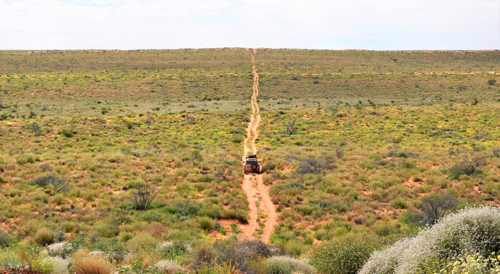
These rough, unmaintained tracks cross the hundreds of parallel dunes that fill the desert like frozen waves in an ocean of sand. Unlike the drifting dunes of the Sahara, the sandhills of the Simpson are covered in vegetation, which has kept them relatively stable.
One of the most popular routes is the clay-capped Rig Rd, which was built to transport heavy equipment. Over time, the hard capping has become so eroded by vehicle impact and weather, it no longer offers the relatively smooth ride it once did. Deep ruts and washaways make for treacherous driving conditions.
Other options for people travelling west to east are the WAA Line and Knolls Track, or the extremely sandy French Line, and then the QAA Line from Poeppel Corner (the corner of NT, QLD and SA) to Birdsville.
Crossing the Simpson can be seriously challenging, and it’s vital to be fully prepared. You’ll need a suitable, well-maintained vehicle, recovery gear and some basic spares, including at least two complete spare wheels. Carry plenty of water, food and fuel, and make sure you have communication equipment to contact the outside world in case of emergency.
It’s also some of the most fun you’ll ever have.
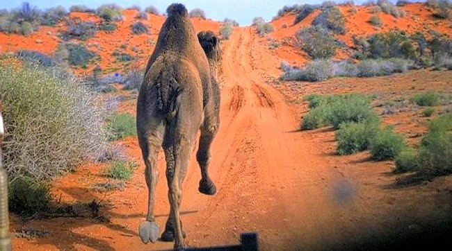
This is the true wilderness and every day is an adventure, from tackling dune crossings and winding around salt pans, to spotting wild camels and dozing off to the mournful howl of a distant dingo.
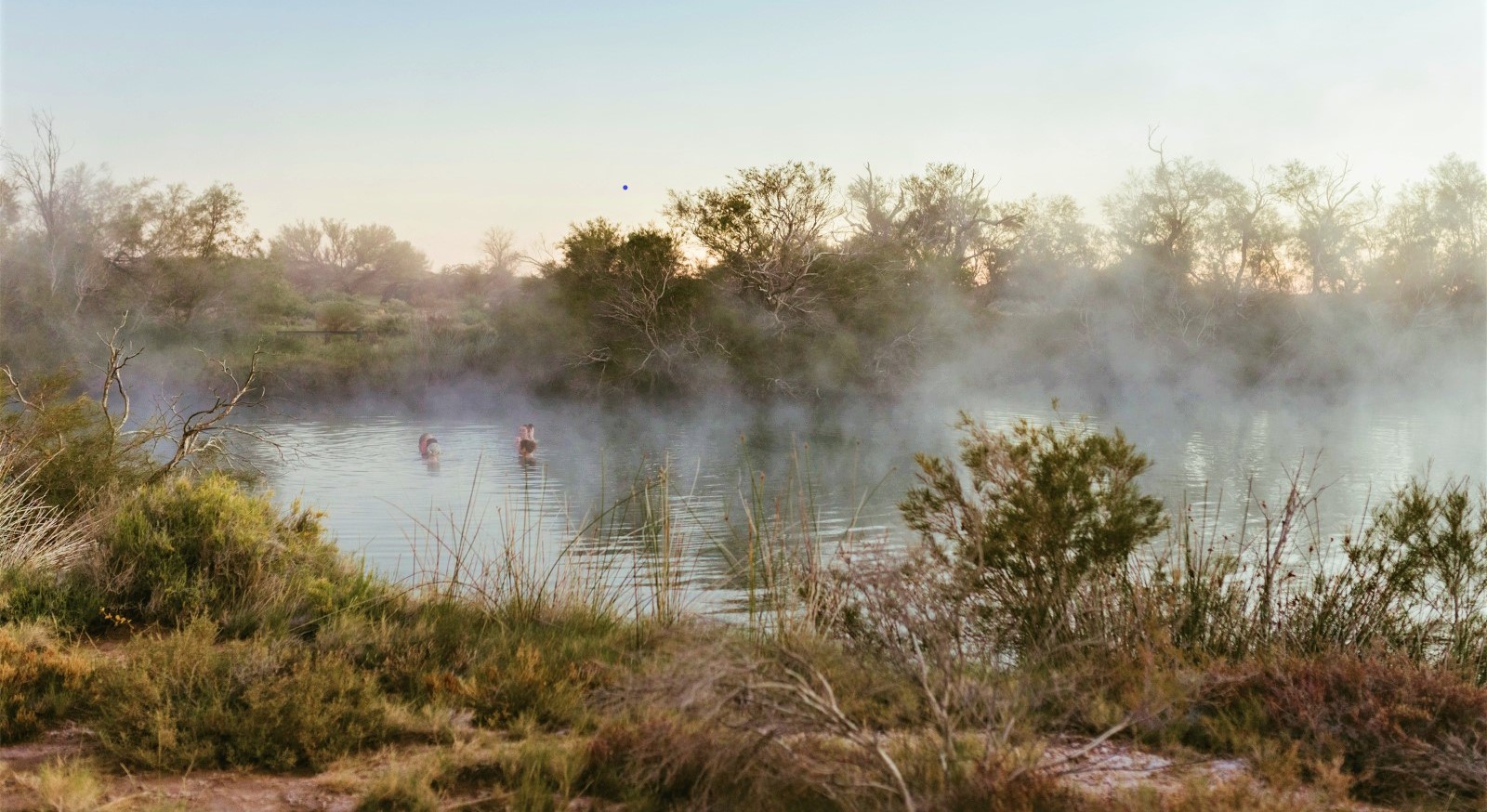
No trip across the Simpson would be complete without a stopover at Dalhousie Springs, a classic desert oasis. Bubbling up from the Great Artesian Basin at about 38⁰C, the spring sits among a dense thicket of paperbarks, and is just the spot for a dip on a chilly desert night. The camping ground has toilets and cold showers, and sites must be booked online.
Nuts and bolts
- Munga-Thirri–Simpson Desert National Park is closed from 1 December to 15 March each year.
- A Desert Parks Pass is required if you’re crossing the Simpson, but isn’t required if your not travelling east of Dalhousie Springs. If you’re only visiting Dalhousie Springs, Witjira National Park permits are purchased online.
- Carry a reliable GPS navigation unit and paper maps.
- Check the Outback Road Report and Desert Parks Bulletin before heading off.
- Safety flags must be attached to vehicles travelling in the park – be prepared to encounter oncoming vehicles at dune crests.
- There’s no mobile phone coverage ‒ it’s strongly recommended you carry a satellite phone or HF radio (or Iridium Go/Thuraya SatSleeve, which allow your mobile phone to be used as a satellite phone), plus a UHF radio for communication with other vehicles. You might also consider taking a GPS-encoded distress beacon (EPIRB).
2. Ninety-Mile Desert (Ngarkat Conservation Park)
The Dukes Hwy to Melbourne passes through a region known as the Ninety-Mile Desert, once considered to be infertile wasteland. Covering an area of about 1.5 million hectares, it extends north from Keith and Bordertown towards Pinnaroo and into Victoria.
In the 1940s, it was discovered that adding a dash of copper and zinc to regular fertilizer could turn the region into productive farmland.
But one vast area of sand dunes proved too difficult to tame and this patch has since become the marvellous Ngarkat Conservation Park.
Most off-roaders know of the hefty sandhills along the park’s challenging border track, but there’s so much more to Ngarkat.
In the south, the transition from cultivated fields to desert shrubs is abrupt, with the two zones separated by a few thin strands of wire. On one side, pivot irrigation tends to the spring onion crops, while on the other side a diverse collection of native grasses, shrubs and eucalypts cloak an extensive dune system.
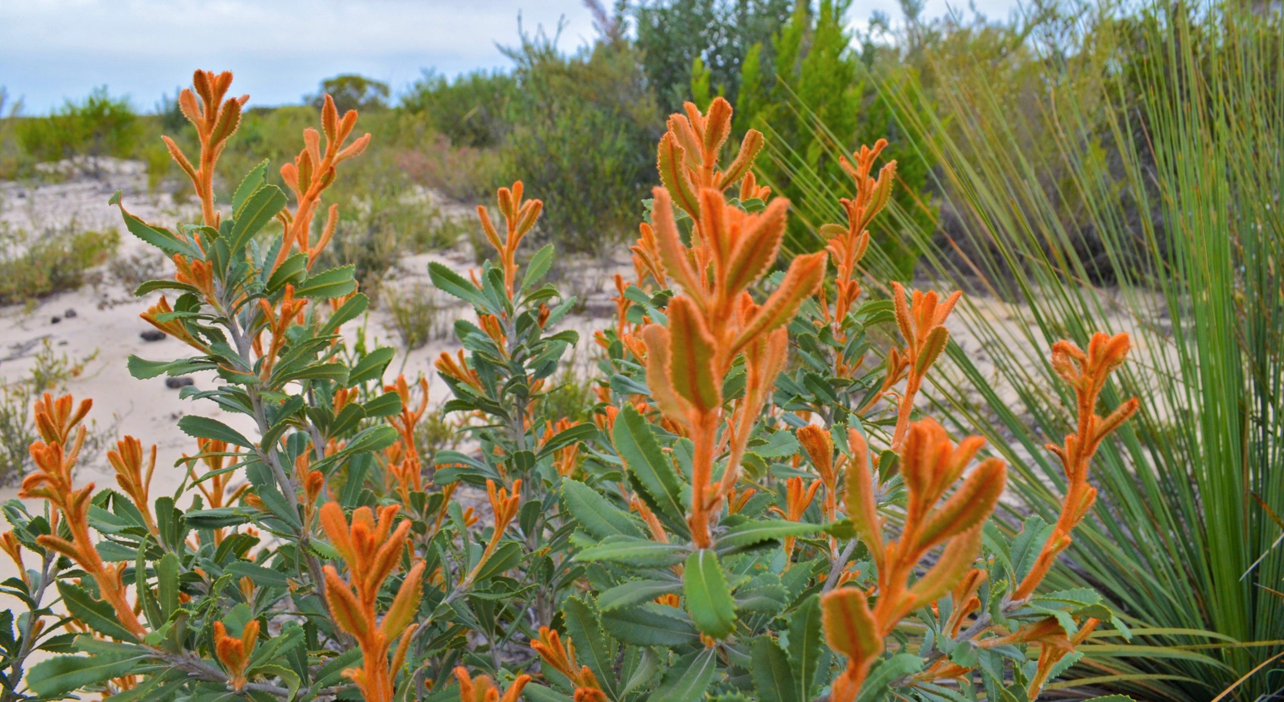
Kangaroos, emus and birdlife abound, and in wildflower season the park can become a colourful garden.
One particularly pretty drive follows Jimmy’s Well Track to Box Flat, leaving Ngarkat to the north on Baan Hill Rd. The diversity of vegetation en-route is remarkable, and there are plenty of dunes to cross.
If you enter the park via Buck’s Camp Track or Gosse Hill Track, there are two delightful camping areas to choose from – Rabbit Island Soak and Buck’s Camp. Nestled among the eucalypts, Rabbit Island is as pretty as a picture, with plenty of clear areas to set up a tent. Buck’s Camp is a little more open and includes the crumbling stone ruins of an old settler’s cottage.
Nuts and bolts
- The one-way section of the Border Track is closed from 1 November until 31 March each year.
- There are several campgrounds but only two have toilets – Pertendi Hut and Pine Hut Soak in the eastern section of the park.
- There are several walking tracks in the park.
- There’s no mobile phone coverage.
- Camping and entry permits can be organised online or through booking agents.
3. Great Victoria Desert
After World War II the Australian Government decided to get into the rocket testing business and a big chunk of land was needed.
Often described as the last Australian explorer, army surveyor Len Beadell was tasked with surveying an impossibly vast area across the Great Victoria Desert in northern SA and part of Western Australia. This became the Woomera Rocket Range (now the Woomera Range Complex), which once covered a whopping 270,000 square kilometres of desert – since reduced to a mere 122,000 square kilometres.
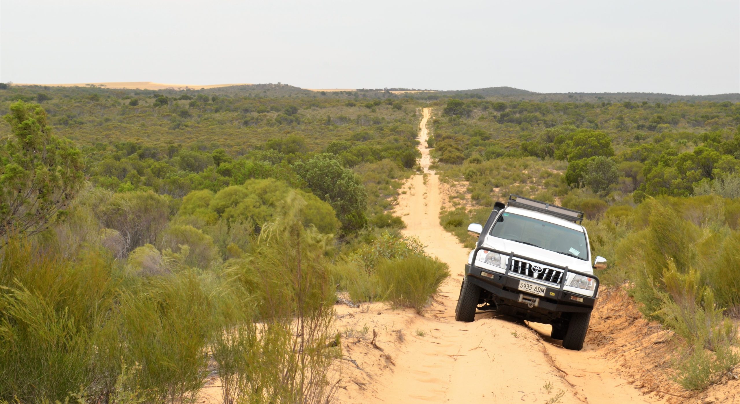
Len and his team surveyed and built several lengthy tracks across the region, naming some of them after his family. The Anne Beadell Hwy, named after Len’s wife, links Coober Pedy to Laverton in WA, covering a distance of more than 1300km.
Don’t be fooled by the tongue-in-cheek misnomer. Far from being a highway, it’s a rough, narrow, and corrugated track, and there are washouts and detours. In places, the vegetation leans so close to the track it’s unlikely you’ll complete the trip without a few new pinstripes on your paintwork.
The sandy surface is fairly firm and, although there are dunes to cross, they’re not as big as those in the eastern section of the Simpson Desert.
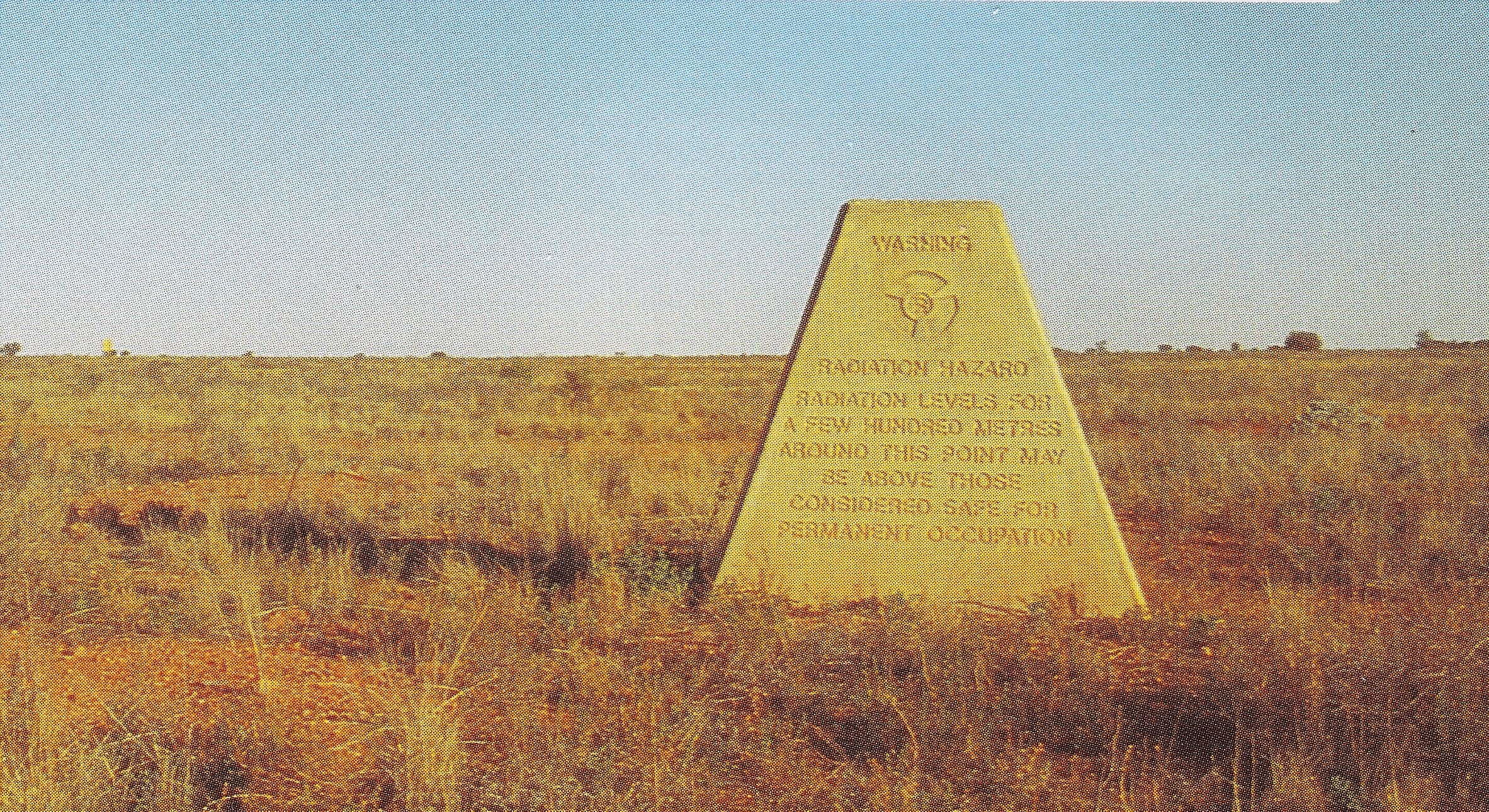
In the days when atmospheric testing of nuclear weapons was considered a sensible idea, a few atomic bombs were detonated in outback SA. Most Australians have heard of Maralinga but the original 1953 test site was much further north at a place that became known as Emu.
Although aging signs warn of the high radiation levels in the area, travellers still make their way from the Anne Beadell Hwy to the two concrete ground-zero obelisks that mark the blast sites. Paradoxically, this is a place of absolute serenity, and apart from the odd melted pebble there are few clues as to what went on here.
If you’ve had enough before you reach the state border, turn south at Vokes Hill Corner and take the rough track south to Cook on the Indian Pacific rail line. Then follow the unsealed road across the Nullarbor’s treeless plain to the Eyre Hwy.
Nuts and bolts
- Permits are required to enter the Woomera Prohibited Area, Maralinga Tjarutja Land, Tallaringa Conservation Park, and for camping in the Mamungari Conservation Park (permits for Mamungari CP are available through the Maralinga Tjarutja site above).
- Currently permits are not being issued for access through Maralinga Tjarutja land due to COVID-19.
- This is as remote as the outback gets and you’ll need to be totally self-sufficient in regard to vehicle preparation, fuel, food, water and recovery gear.
- Carry an HF radio or satellite phone (or Iridium Go/Thuraya SatSleeve, which allow your mobile phone to be used as a satellite phone), plus a UHF radio to chat with other vehicles in your group. It’s also worth taking a GPS-encoded distress beacon (EPIRB).
- Carry a quality GPS navigation unit and paper maps.